
Surveyors
Geotech
Town Planners
GIS Specialists
Drone Pilots
GPR Utilities Detection

SERVICES

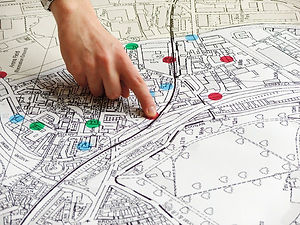

Land Surveys
Professional land surveyors perform cadastral surveys, which involve complying with the laws of land ownership and the definition of property boundaries. The land surveyor conducts a physical survey to relocate or demarcate the corner points of a property and subsequently prepares the necessary diagrams and survey records for submission to and approval by the Surveyor-General. These survey diagrams are regarded as the foundation of South Africa’s land registration system as they portray the exact location, size and boundaries of a property.
Cadastral surveys involve any of the following:
-
subdivisions
-
general plans
-
amending general plans
-
consolidating land parcels
-
servitudes / servitude plans
-
leasehold areas
-
usufruct areas
-
boundary relocation
-
issuing of land surveyor’s certificates
-
certificates of identity for financial institutions
-
beacon relocations certificate
-
beacon agreements
-
farm surveys
Town Planning
We offer urban and regional planning services. For instance, rezoning, consent use, removal of title deed conditions, and townships. Through our partners, we offer our clients environmental authorization, bulk services, and geological reports.
-
Revision of Land Use Management / Town Planning Schemes
-
Applications for the amendment of Land Use Management / Town Planning Schemes (e.g. rezoning applications)
-
Applications for consent use
-
Applications for subdivision & consolidation of erven or farm portions
-
Applications for township establishment for:
-
the provision of inclusionary government housing
-
the provision of bonded housing
-
the provision of commercial development
-
the provision of Industrial development
-
-
Correct interpretations of town planning and related legislation
GIS and Drone Surveys
As a GIS services company, our GIS consultancy teams can provide an individual GIS consultant for smaller tasks or a team of consultants for large-scale GIS enterprise consulting.
All our GIS specialists, developers, and designers are experienced industry consultants that can assist you with your project and business needs.
We house several market-dominant and market-leading geospatial products in the fields of GIS, business mapping software as well as intelligence tools. Let us use our expertise and technology to save you money and enable you to get the location-based results that will make your organization more efficient.
SERVICES


Geotechnical Investigations
-
Desktop evaluation comprising interpretation of aerial photographs and geological maps
-
Inspection pits and trial auger holes
-
Geotechnical borehole drilling
-
Penetrometer testing comprising DCP, DPL etc.
-
Slope Stability Assessments
-
Road centre line and materials surveys
-
Insitu tests such as plate load tests
-
Project feasibility assessments
-
Full-time supervision of all activities by qualified personnel
Ground Penetrating Radar (GPR)
-
Precise location of underground utilities (water, electrical, sewer, fibre)
-
As-built verification for municipal GIS and asset management
-
Pre-construction scanning for IRDP, UISP, and FLISP projects
-
Identification of old foundations, tanks, and buried objects.
-
Detection of rebar, post-tension cables, and conduits
-
Identification of shallow subsurface voids, sinkholes, or karst features
-
Locating unmarked graves for municipal cemetery expansions
-
Runway subsurface assessment for safety compliance
-
Integrated GPS and CAD-ready outputs

Imagery Sales
Using Satellite Imagery and Geospatial Techniques. We are bale to extract and sell the following products, base on square kilometer rate at supplied area of interest(AOI) :
-
Latest aerial or satellite images (0.1–2 m).
-
Topographic Maps: Maps showing natural and artificial features (0.5–2 m).
-
Digital Elevation Models (DEM): Surface elevation data (0.5–5 m).
-
Digital Surface Models (DSM): Elevation of terrain and structures (0.5–2 m).
-
Digital Terrain Models (DTM): Bare-earth elevation data (1–5 m).
-
Building Footprints: Boundaries of buildings (0.1–1 m).
-
LiDAR extracts
Clients are requested to email the Area of Interest for a quotation.
Professional Accreditations and Registrations


ABOUT
Founded in the year 2018, the company prides itself in a vast amount of experience in both the private sector as well as the public sector. The team of directors are skilled and registered Professional Land Surveyors, Town Planners and GIS Professional. They are also registered Drone Pilots and Sectonal Title Practtioners. Past experience includes working with Architects, Conveyancers as well as Civil Engineers. For any advisory services in the Engineering and Built Environment, the company is able to advise and help navigate clients in a cost effective direction. See link to Company Profile
2018
Year Established
160
Projects Completed
23
Contractors Appointed
7
Active Projects
PROJECTS


CLIENTS


PROJECT COVERAGE
Inquiries
Offices :
Kwazulu Natal
- Durban
- Port Shepstone
Western Cape
- Cape Town
Eastern Cape
- East London
- Umthatha
- Flagstaff
Gauteng
- Johannesburg
Free State
- Bloemfontein
Contact Us
Chat to Consultant :
For complex projects such as tenders and multidisciplinary panels, send your email to the director: Survey.Clients@gmail.com